Imóveis e Matrículas
each property with deed and boundaries
Home / Portfolio / FÁBRICA 40 / TOPOGRAFIA

Land surveying and georeferencing
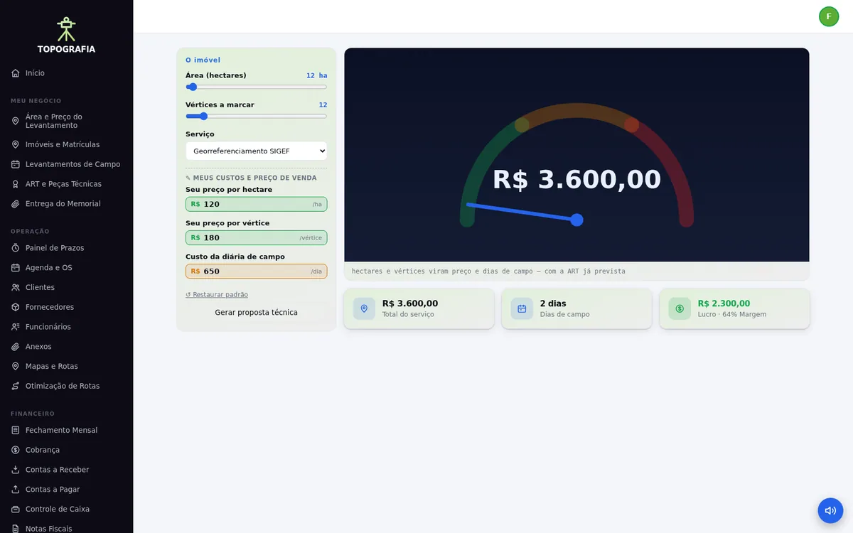
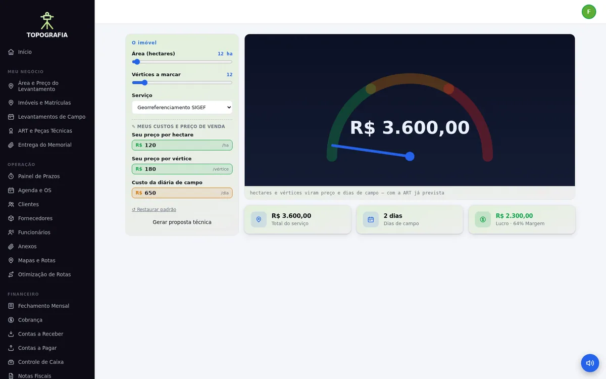
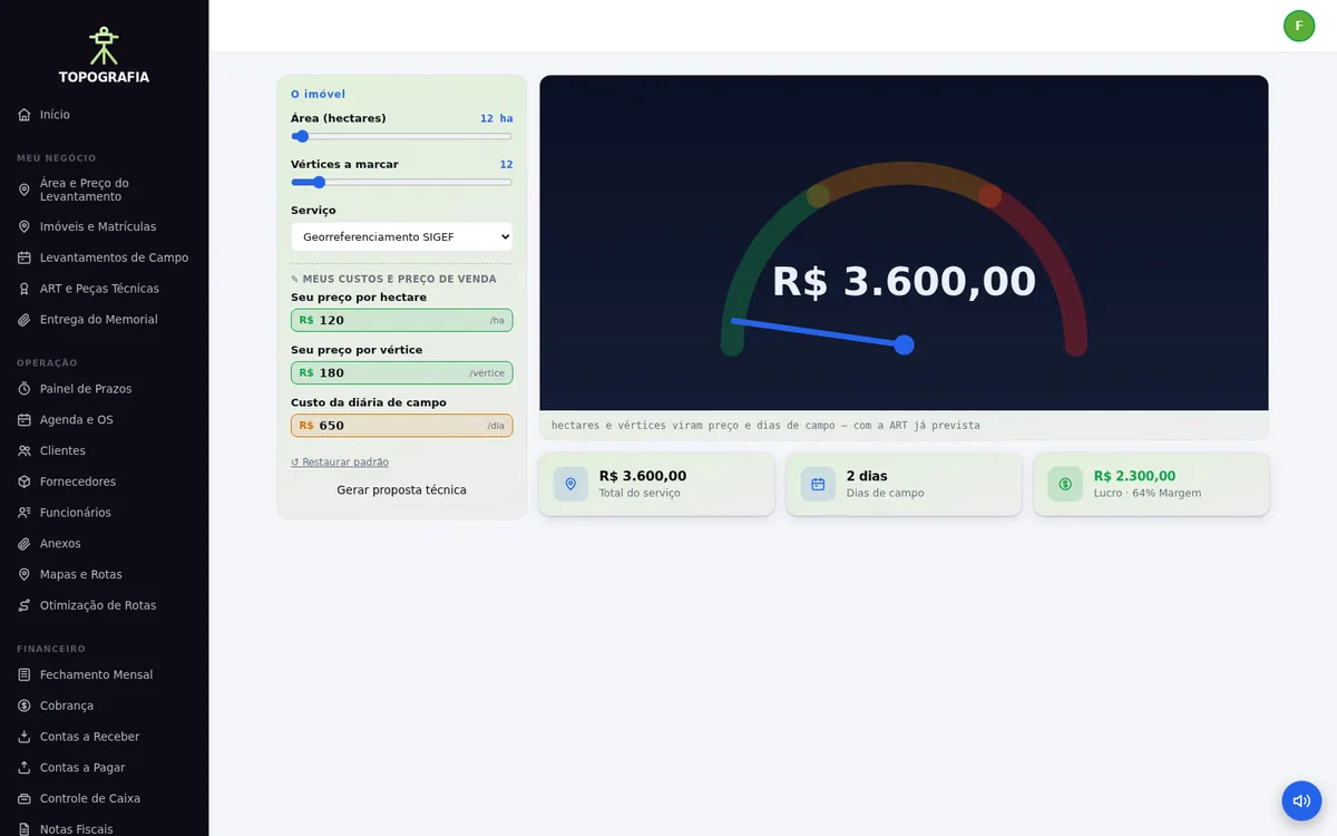
Hectares and vertices become price and field days — before you hit the road.
14-day trial before the first charge. No install, no server: you just open the browser.
topografia.fragasoft.com.br · tick Demo on the sign-in screen and you are in
Surveyors lose money in two places: guessed quotes and forgotten technical filings. The system prices per hectare and per vertex by service type, estimates field days and shows margin after crew cost. Each property keeps its deed, technical documents and filings attached.
★ The differentiator
Area, vertices and service type become price and field days, with crew cost already off the margin.
In your business
each property with deed and boundaries
the field trip recorded with collected data
the professional filing attached to the job
the client receives the survey by link
Ready out of the box
Instant transfer and bank slip billing, invoicing, PDF documents, reports with filters and export, three languages and three themes — plus Clients, Suppliers, Accounts Payable, Accounts Receivable, Cash Control, Calendar and Work Orders, Invoices and System Settings.
Frequently asked questions
TOPOGRAFIA costs R$ 120 per month, per company, with every module included — there is no crippled tier and no per-user charge. The first charge happens at signup; you can cancel whenever you want.
Enter the area in hectares, the vertices to mark and the service type. Price and estimated field days come out with your margin.
Yes, attached to the job alongside the technical documents.
Yes. The survey and attachments go by link for the client to open anytime.
The demo is open: tick Demo on the sign-in screen and you land inside the system, full of sample data, with no sign-up.
R$ 120 per month · first charge today